PROJECT: CHERISH - Impact of Climate Change on Coastal Heritage Project Study Graphics
CLIENT: RCAHMW & Partners
CHERISH (Climate, Heritage and Environments of Reefs, Islands and Headlands) is an EU-funded project led by the RCAHMW Royal Commission on the Ancient and Historical Monuments of Wales, in partnership with the Discovery Programme: Centre for Archaeology and Innovation Ireland, Aberystwyth University: Department of Geography and Earth Sciences and Geological Survey, Ireland.
The project commenced on 1st January 2017 and will run for 5 years until 2022. The key objective of CHERISH is to increase knowledge and understanding of the impacts (past, present and near-future) of climate change, increased storminess and extreme weather events on the cultural heritage of reefs, islands and headlands of Wales and Ireland. The study seeks to fill gaps in both data and knowledge for the coastal regions of Ireland and Wales, to develop a greater understanding of climate change impacts on fragile coastal heritage sites and to establish new metrical precision for the rural, coastal landscapes under study.
OBJECTIVE
I was commissioned to create five interpretive project graphics to feature in a touring exhibition and for use more widely across a range of publications, products and social media posts relating to the study.
The illustrative graphics were to have a clear, appealing and modern style, suitable to engage the public and specialists alike in the work of the project.
When I began the project, CHERISH had an existing logo and simple brand guidelines which included a minimal colour palette (the colours used in the logo) and a simple typestyle for printed documents, so I was given free rein to develop my own colour palette and style for the illustrations.
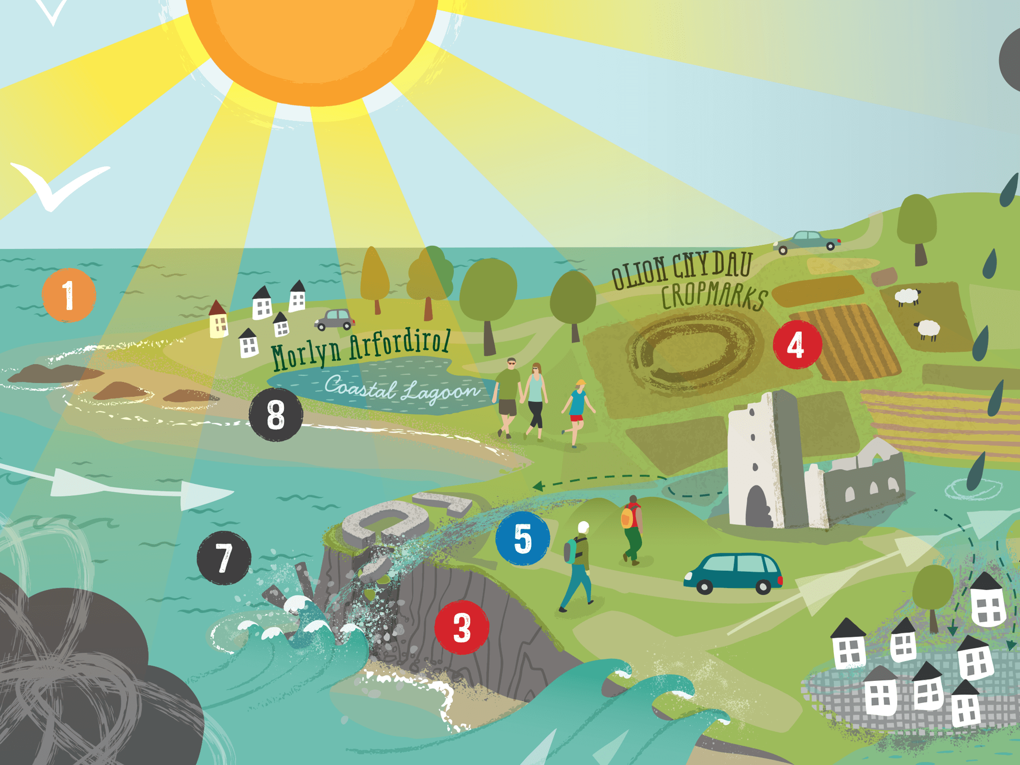
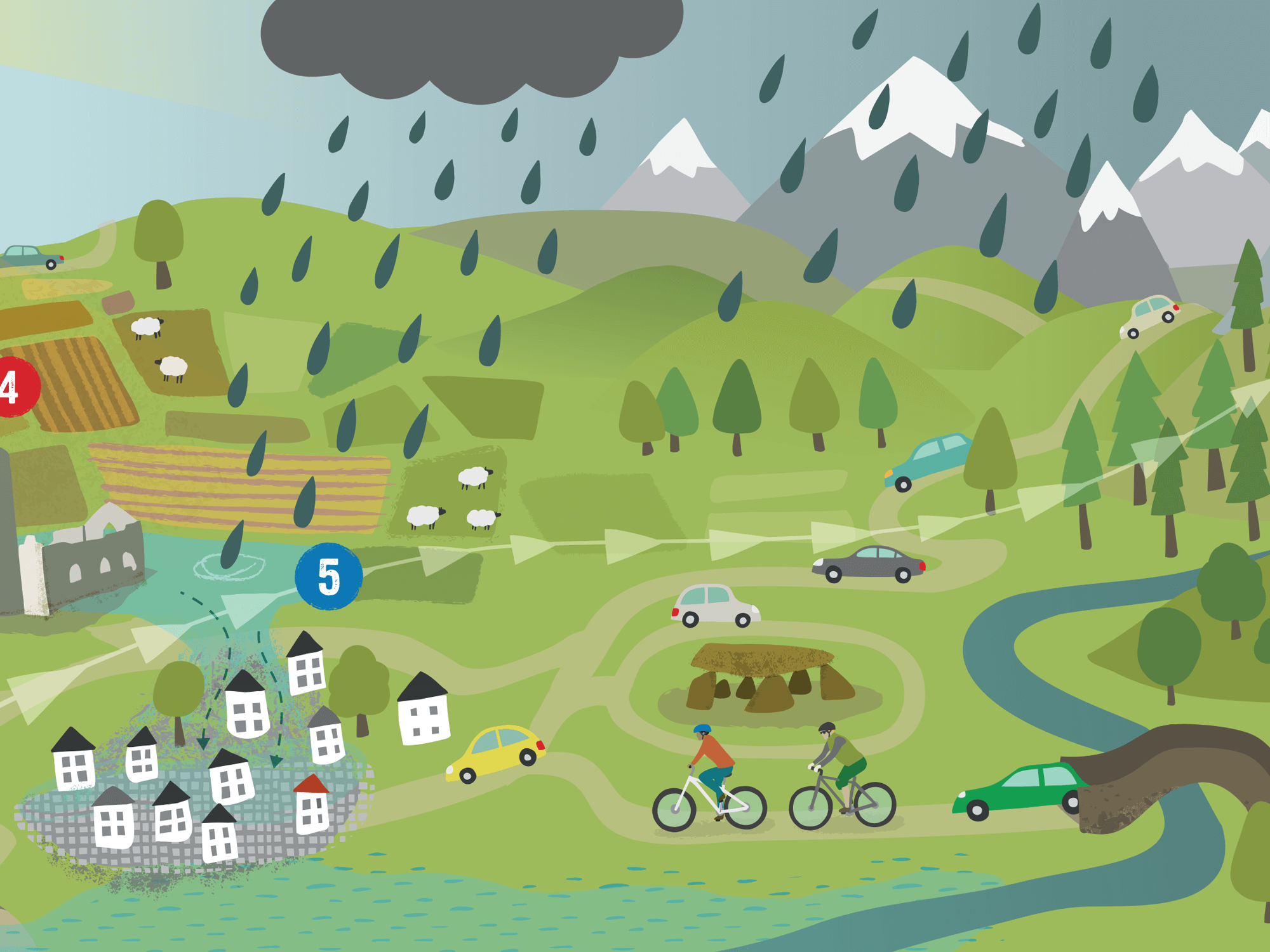
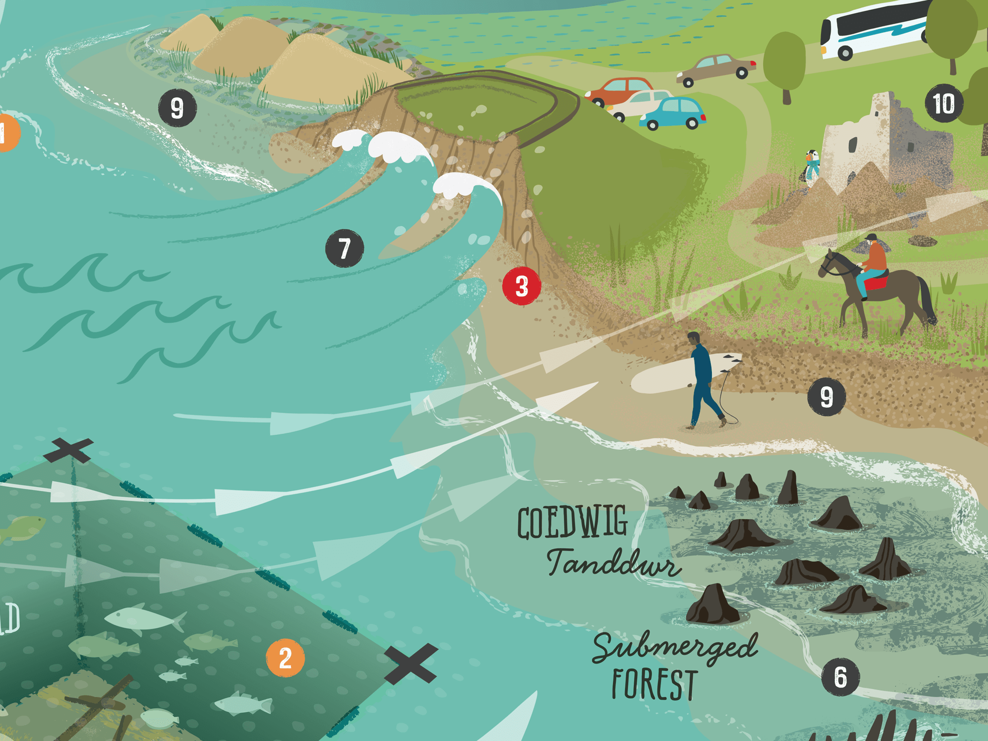
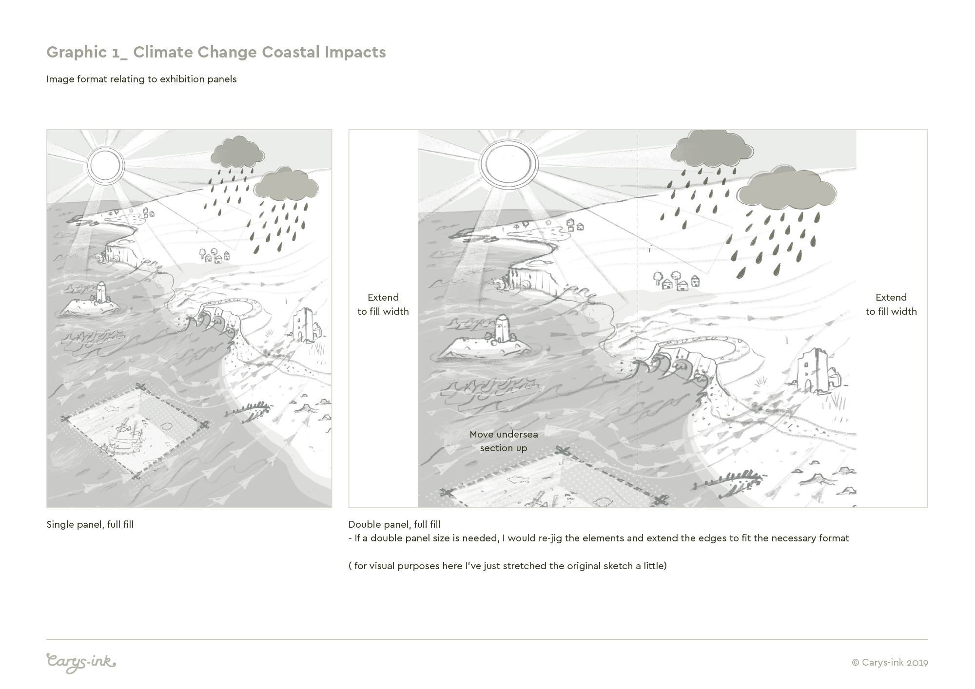
1 - Climate Change Coastal Impacts Graphic
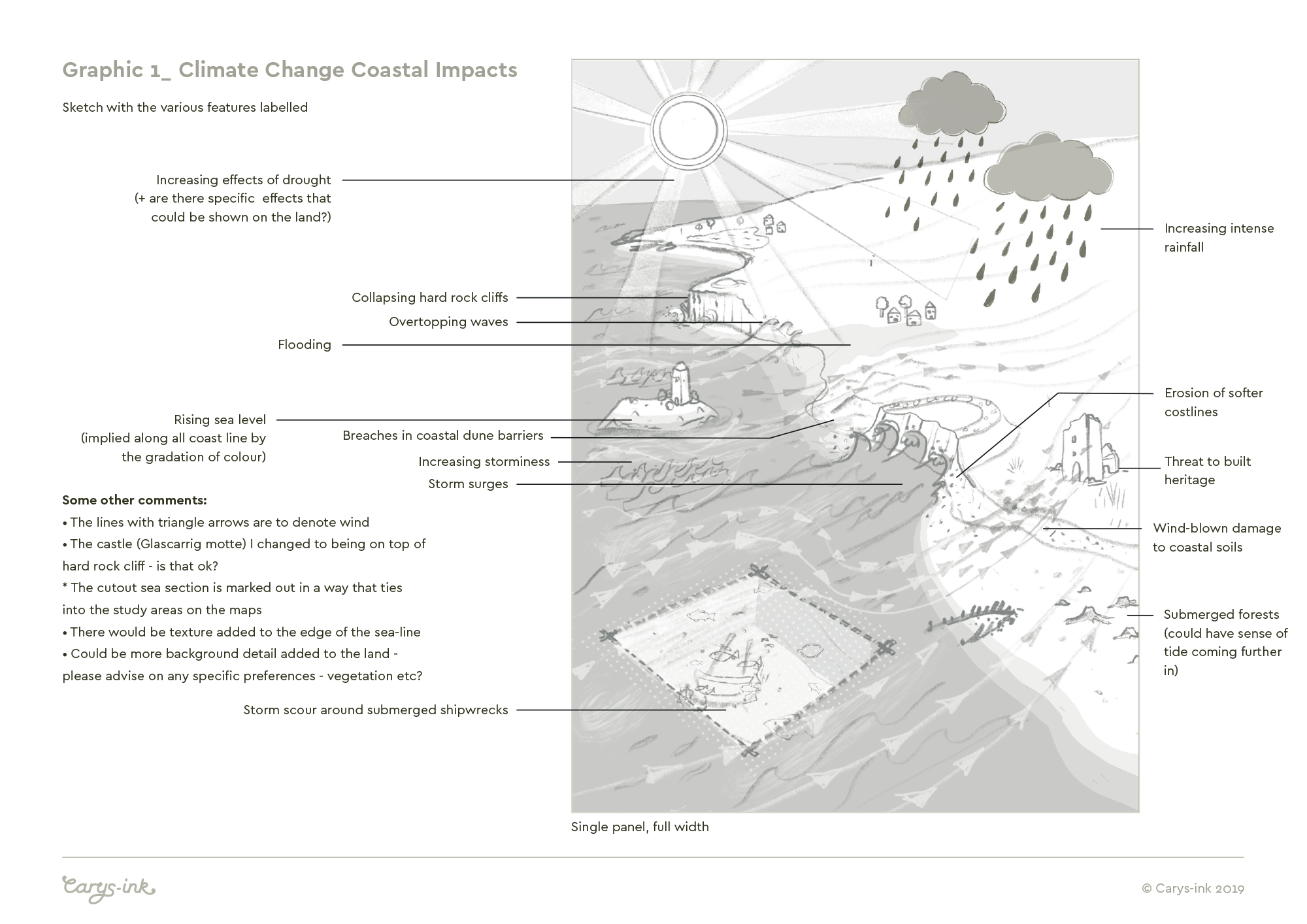
The first illustration (pictured above) is to show the impacts of climate change factors on the maritime and coastal zones of Wales and Ireland - the areas covered by the study. Specifically, I needed to highlight the impacts on terrestrial heritage (eg. promontory forts, castles, abbeys…), maritime heritage (such as undersea shipwrecks, intertidal shipwrecks & hulks) and coastal landscapes (including dune systems, peat bogs, coastal lagoons and ‘submerged forests’). The study is less concerned with built up areas and hard infrastructure such as coastal towns, villages, ports and harbours so it wasn’t necessary to include these in the illustration.
The main challenge for me was to develop an image which could feature all the different landscape features and factors in one overarching illustration. Features are numbered & colour coded with an accompanying key.
Orange - relates to warmer global temperatures
Red - hotter, drier summers
Blue - Warmer, wetter winters
Black - more frequent extreme weather, such as storms.
Lettering on all the illustrations was kept to a minimum as everything produced needed to be dual language - either Welsh/English or English/Irish, depending on where the work would be seen, and this was the main reason for opting to use a key for labelling of features.

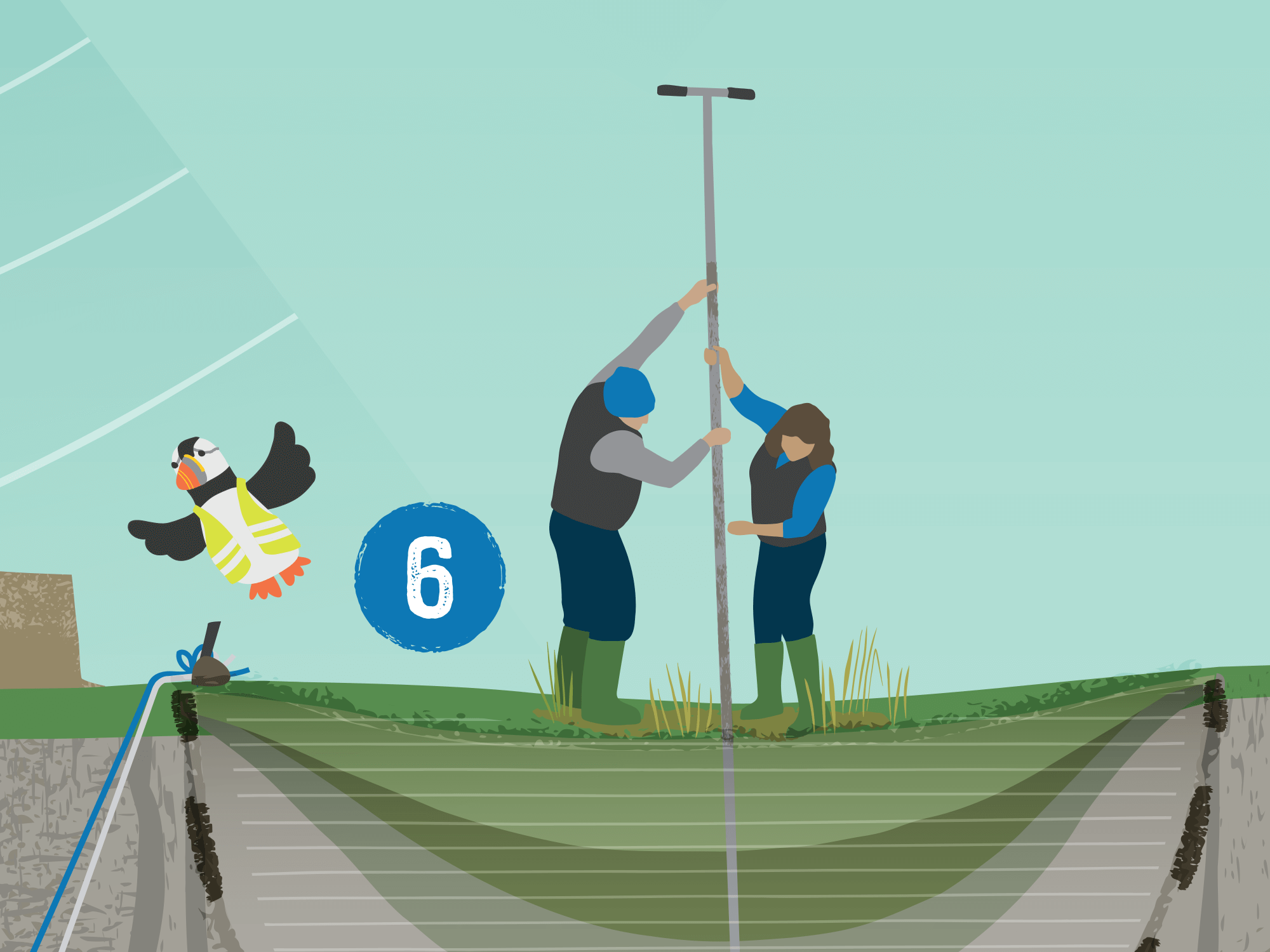
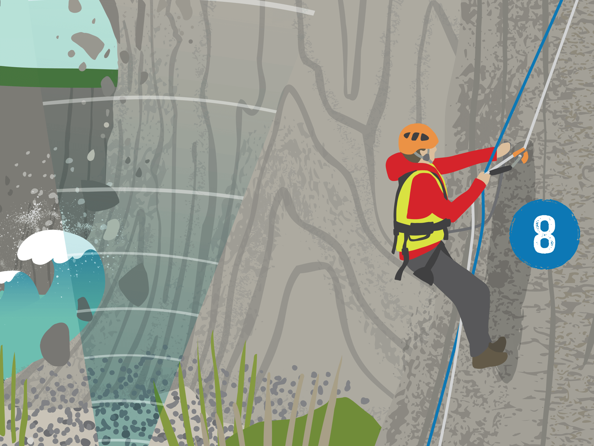
2 - Survey Toolkit Approach Graphic
The Toolkit graphic is to depict the integrated approach the CHERISH team are using for archaeological and geographical surveying on land and under the sea - the various ways being used for surveying, mapping and studying the coastal zone.
Again the main challenge was to incorporate many aspects of research/mapping etc into one illustration, with the relative scale of people, objects and landscape elements using a good degree of artistic licence!

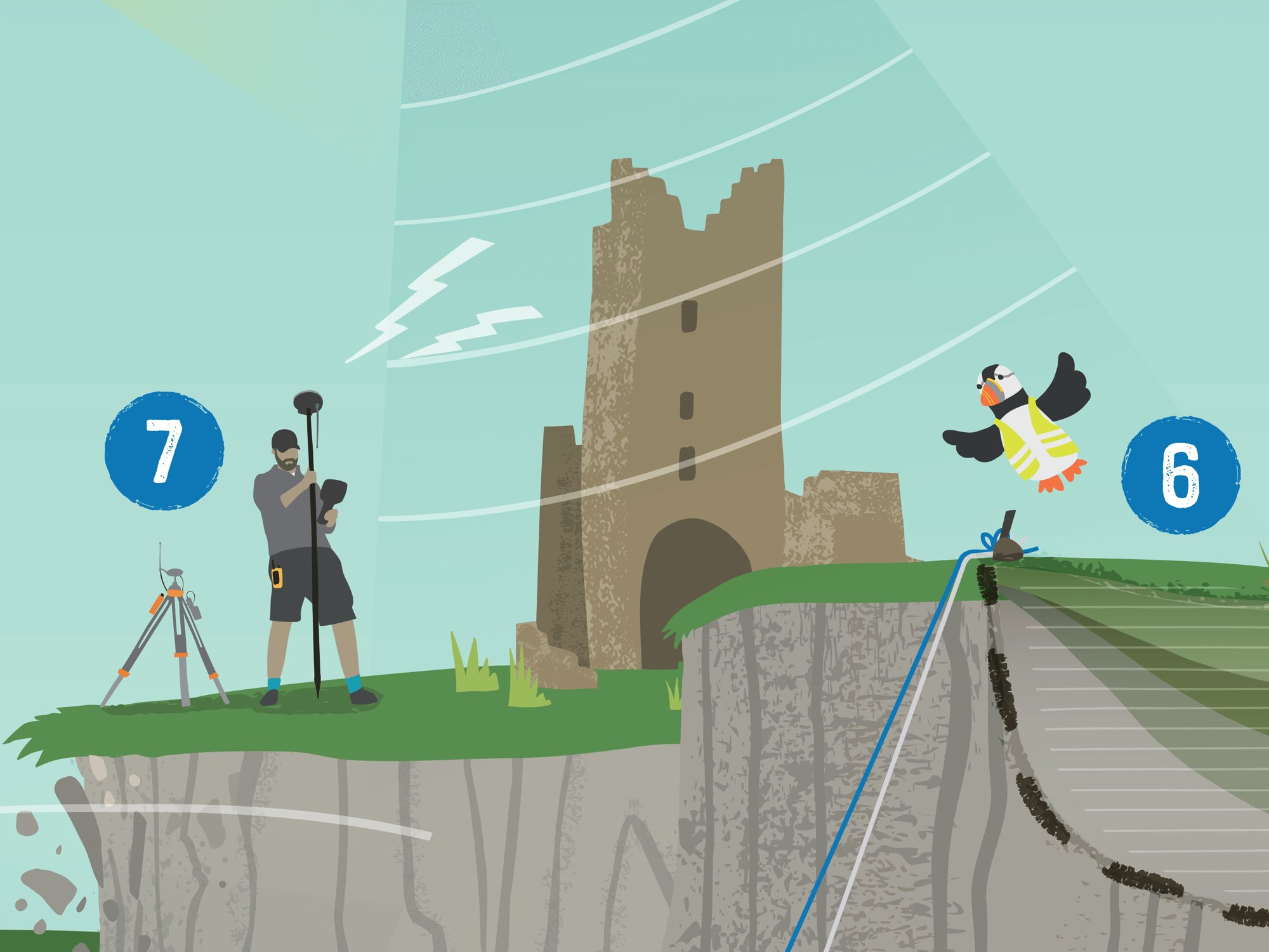
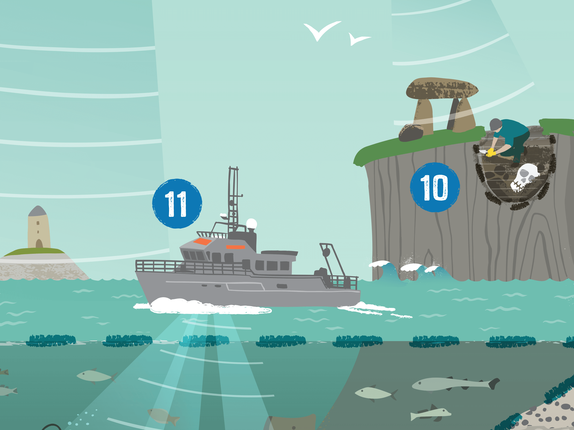
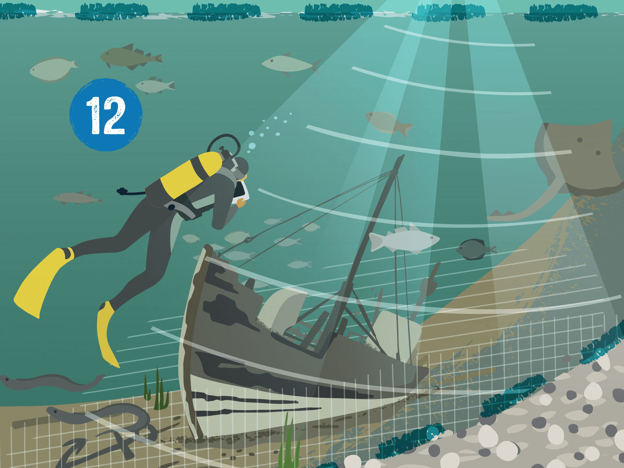
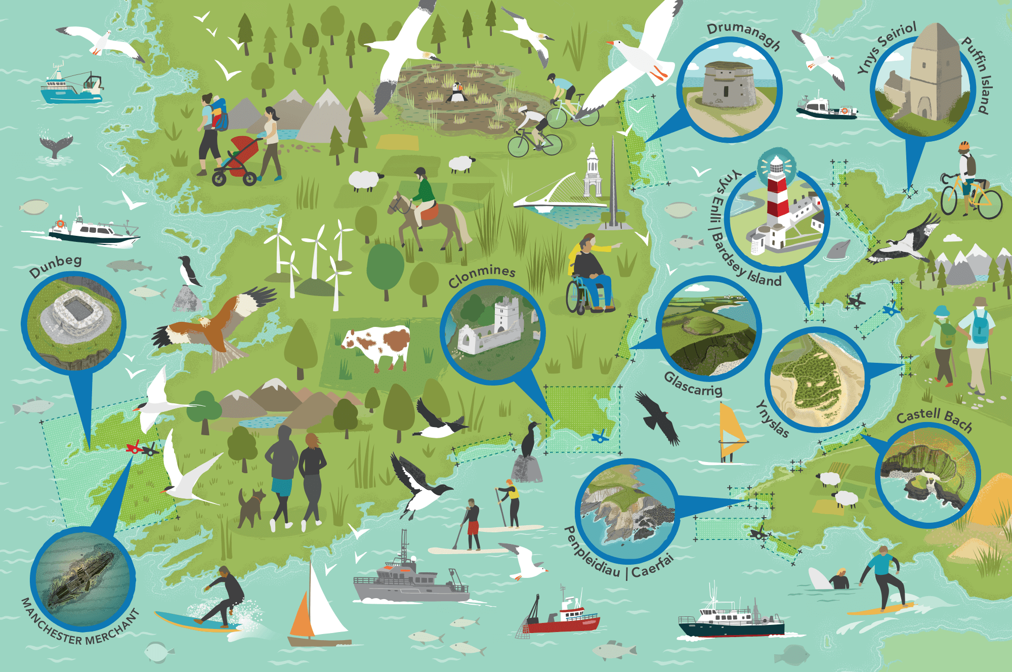
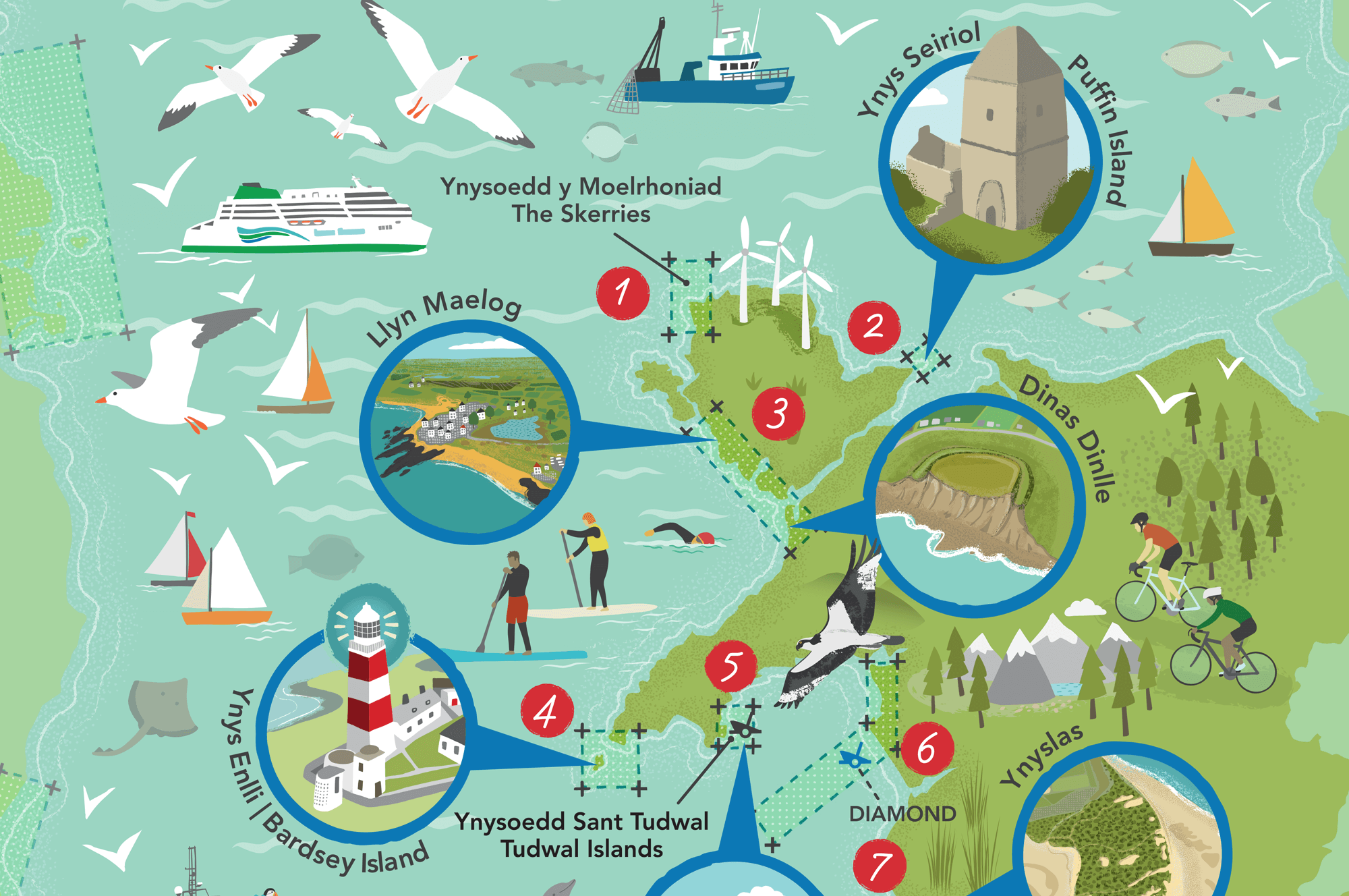
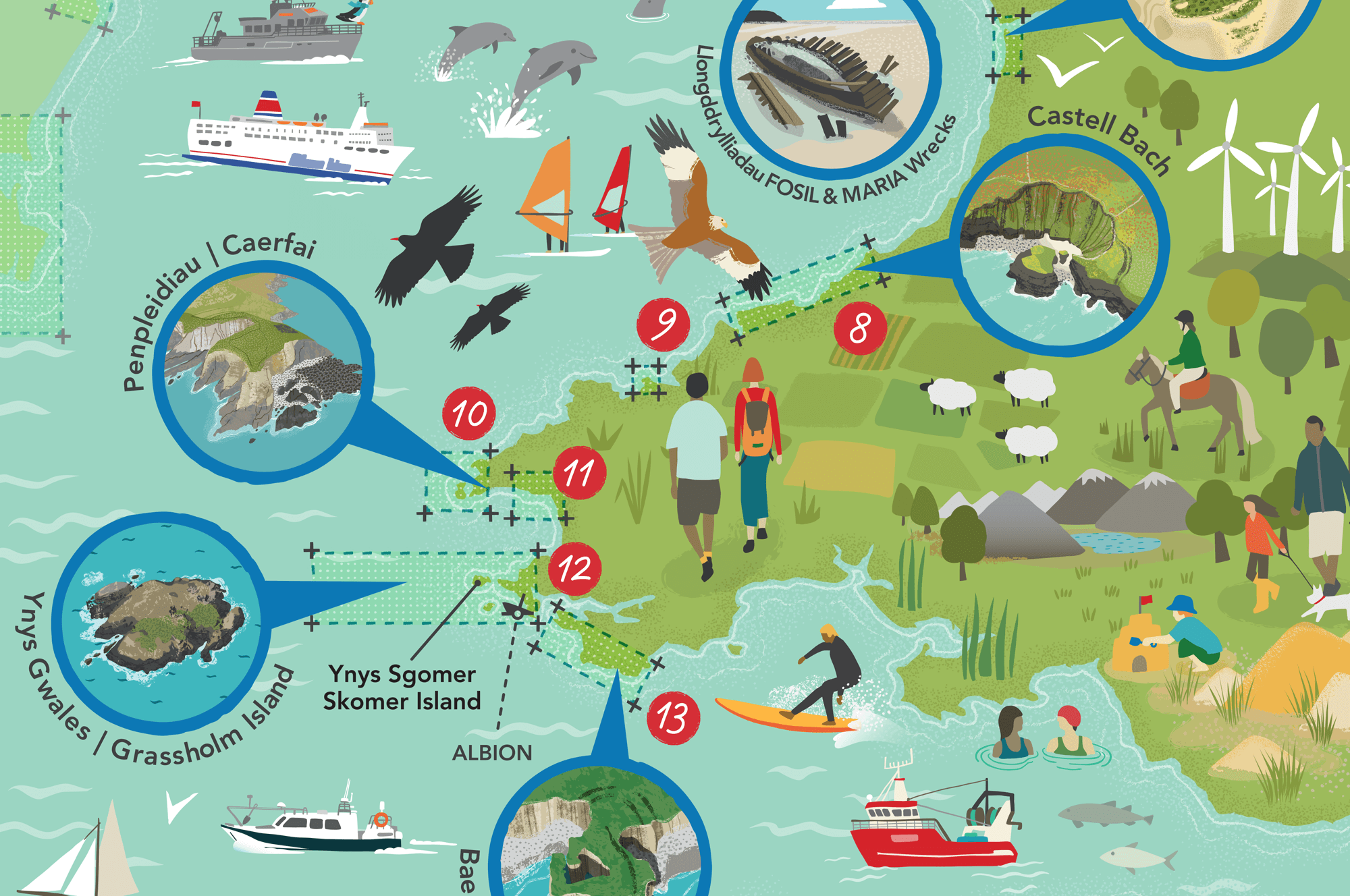
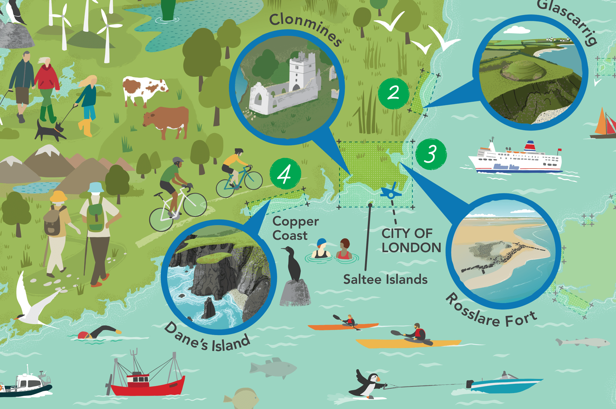
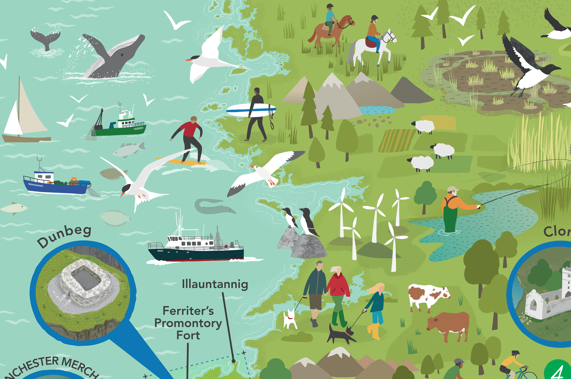
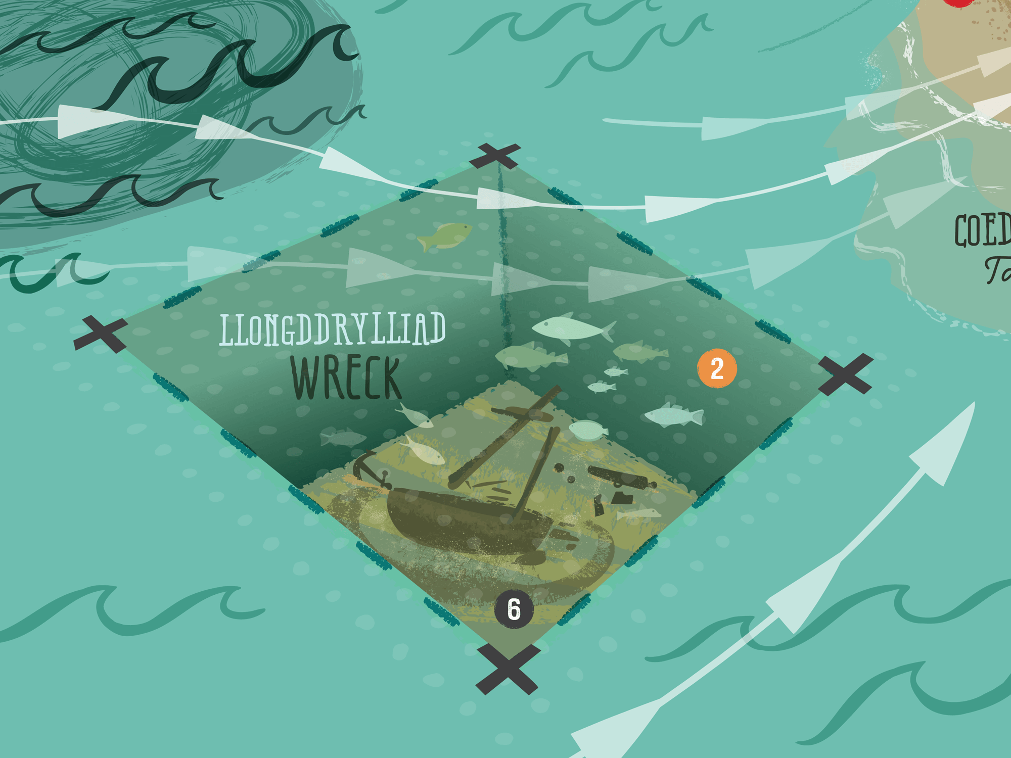
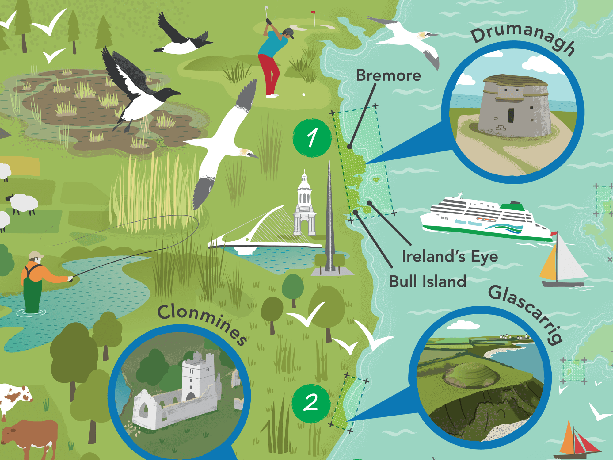
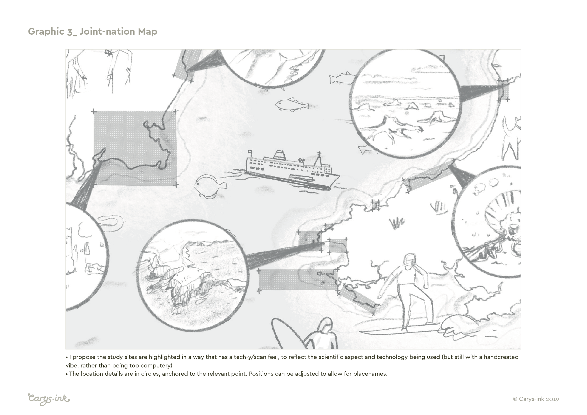
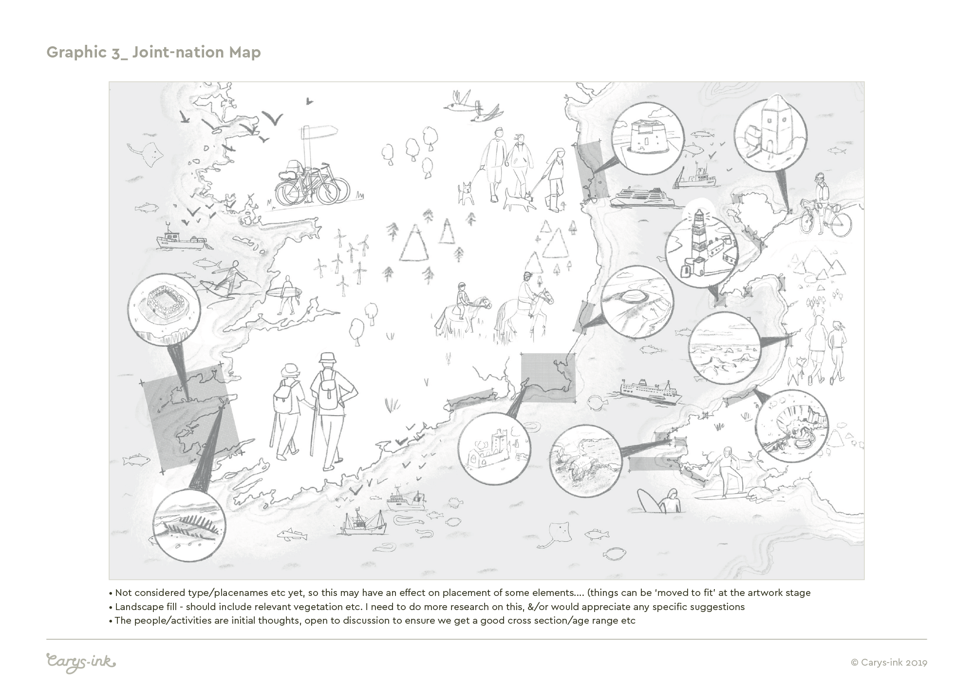
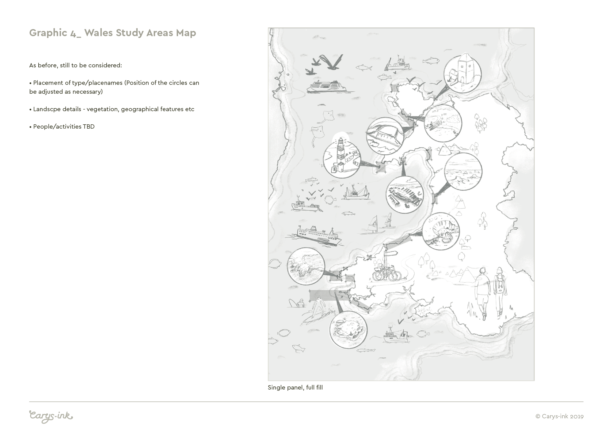
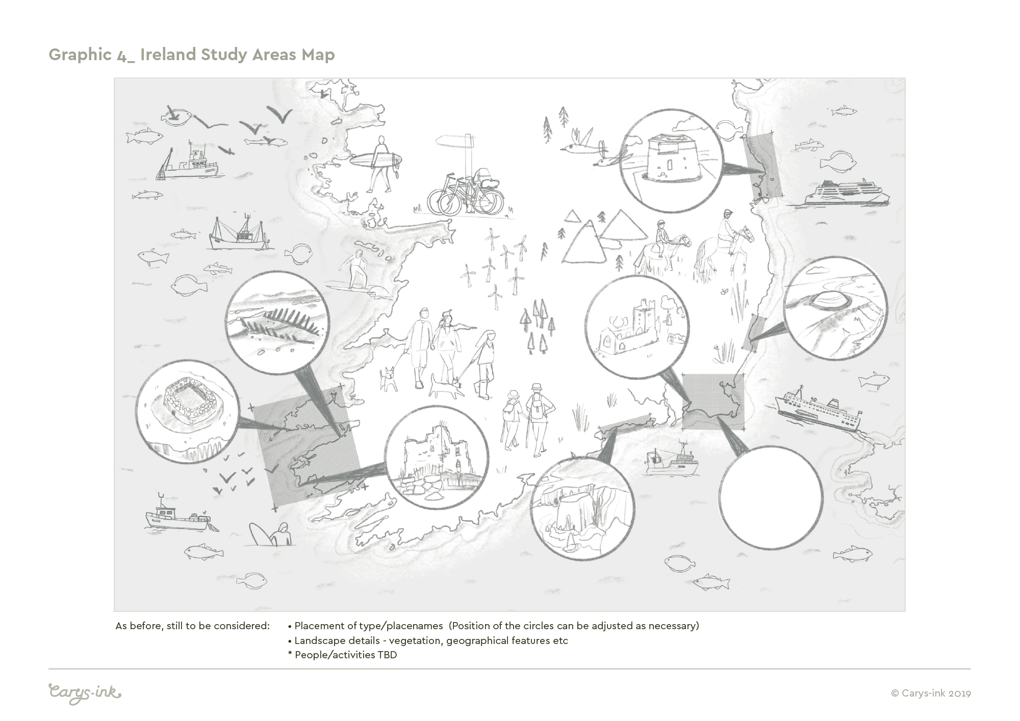
Below are 3 maps to show the key study sites around the coasts of west Wales and southern Ireland. As well as highlighting the study areas, I was briefed to fill the maps with illustrative elements to help them fell vibrant and engaging. Some of the specific study locations are highlighted - selected to show a range of the different types of sites - along with some of the boats/survey vessels used and lots of other activity, wildlife and geographical features to add interest. There is a joint nation map, covering the full study area and then separate maps focussed specifically on the study sites in Wales and Ireland.
All artwork was created in vectors, as this would allow the most flexibility to scale up the illustrations, or any separate elements required, when it came to printing exhibition panels. I originated individual elements for the illustrations using Adobe Draw with the iPad Pro & Apple pencil with fine tuning and compositing everything together being done in Illustrator on my desktop Mac. This is a way I often work, but there were challenges! - By far the most difficult parts to illustrate in a simplified vector style were the specific landscape locations.
3 - Wales & Ireland, Joint Nation Project Areas
CHERISH has a team mascot, a small cuddly puffin called Puffty-Hump (the name came from a competition/call out for suggestions I believe!) who accompanies the team on their various location surveying missions. Puffty features somewhere in all the illustrations, in the style of a ‘Where’s Wally’ - why not see if you can find him?

4 - Project Map for Wales specific study Areas
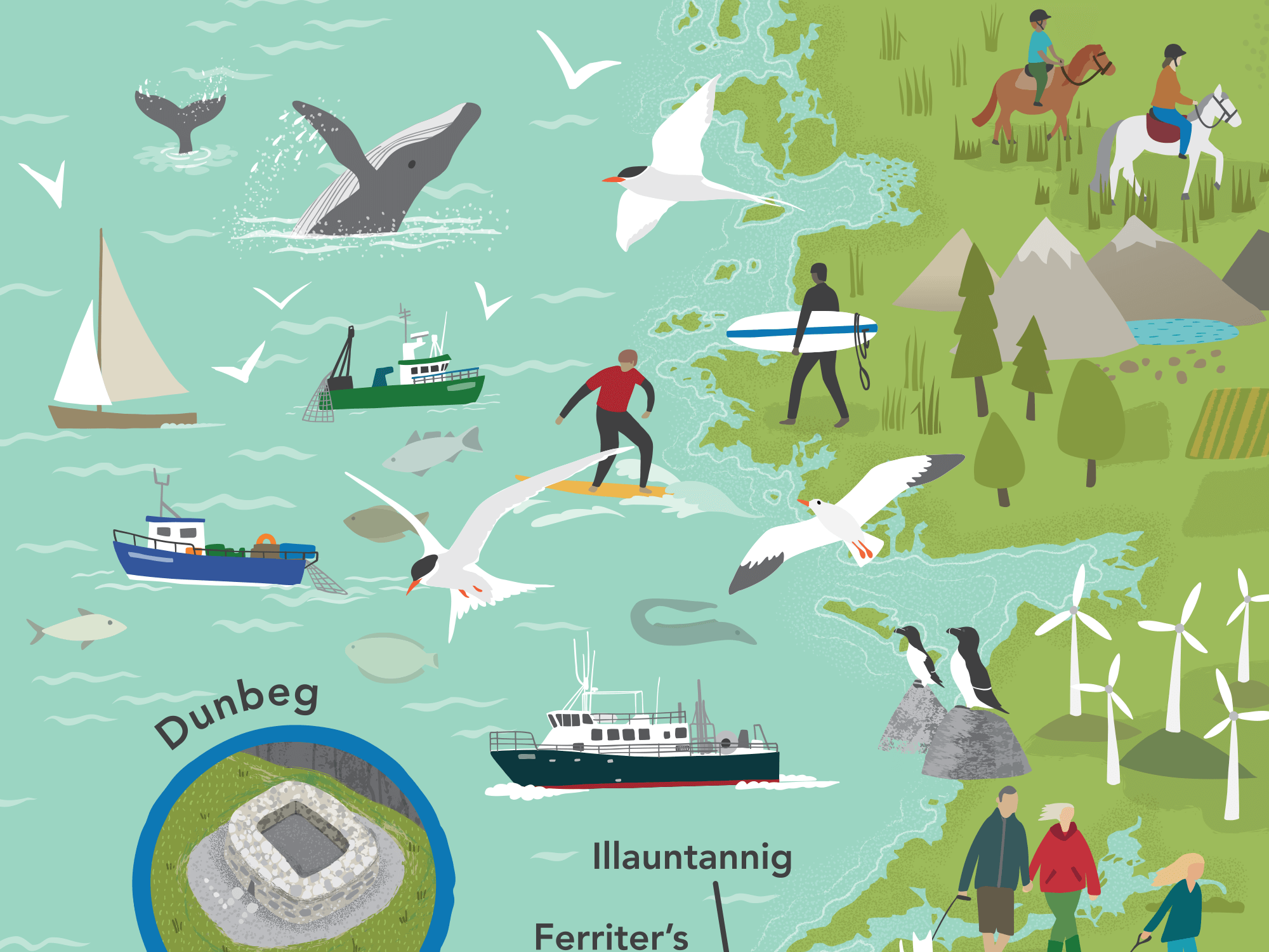
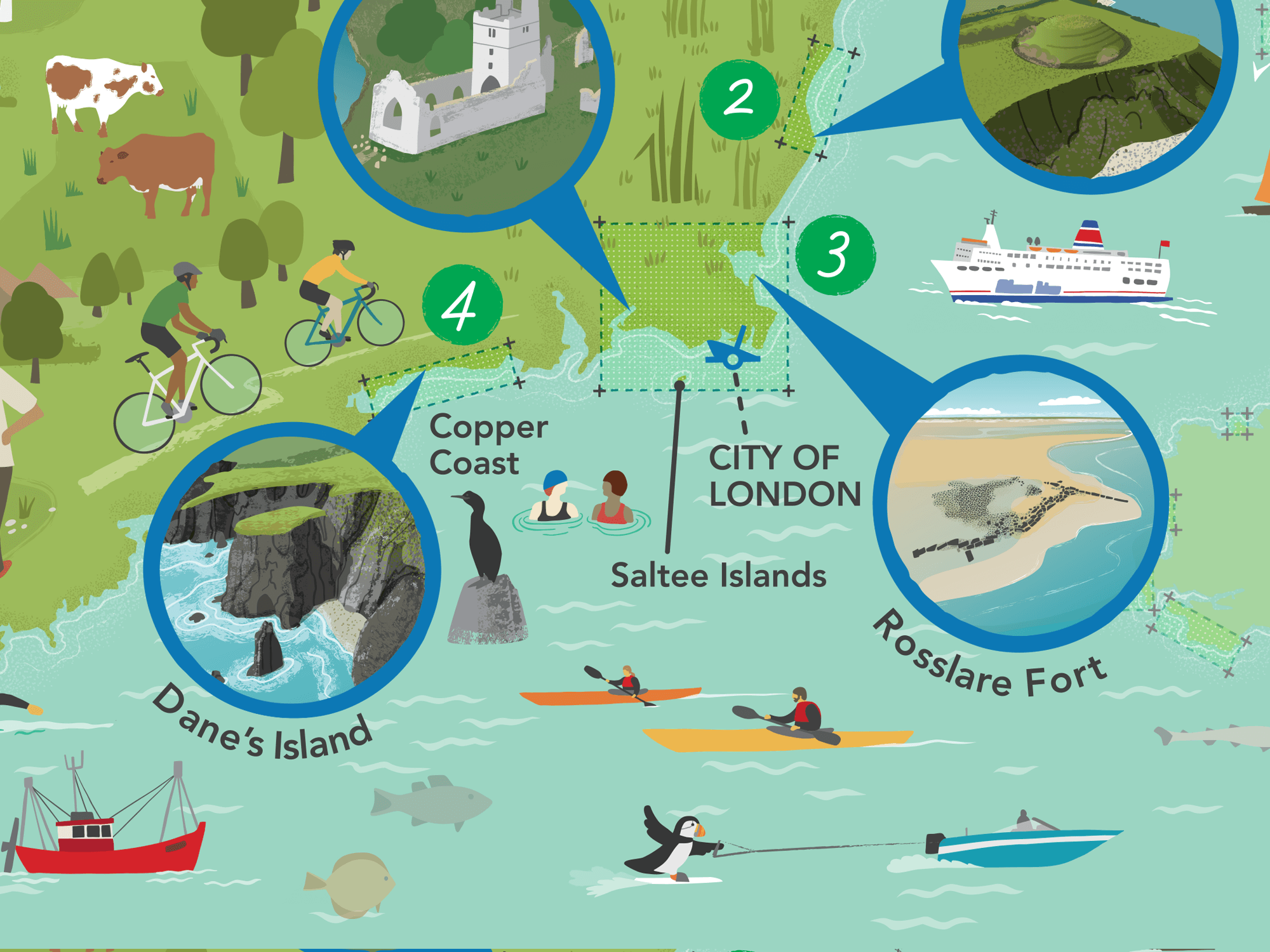
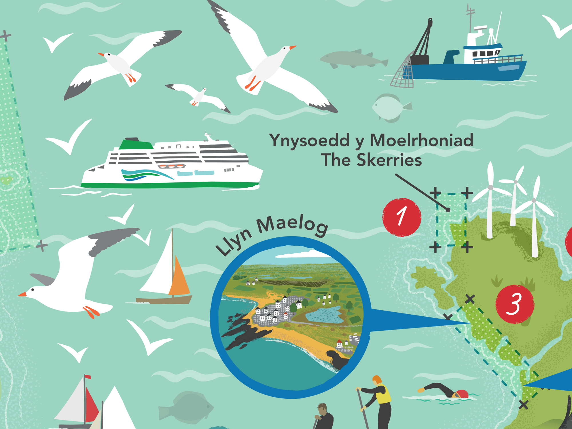
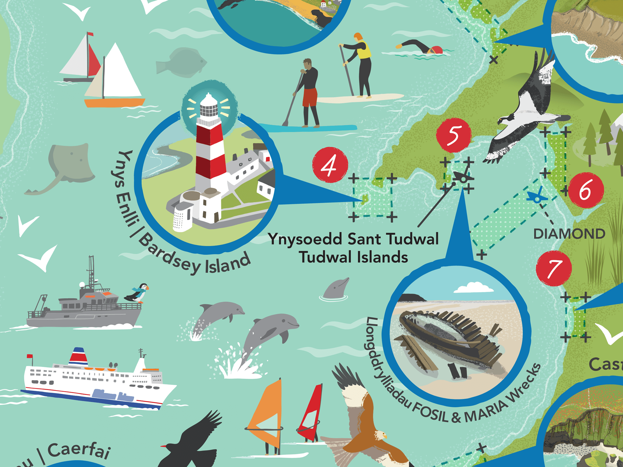
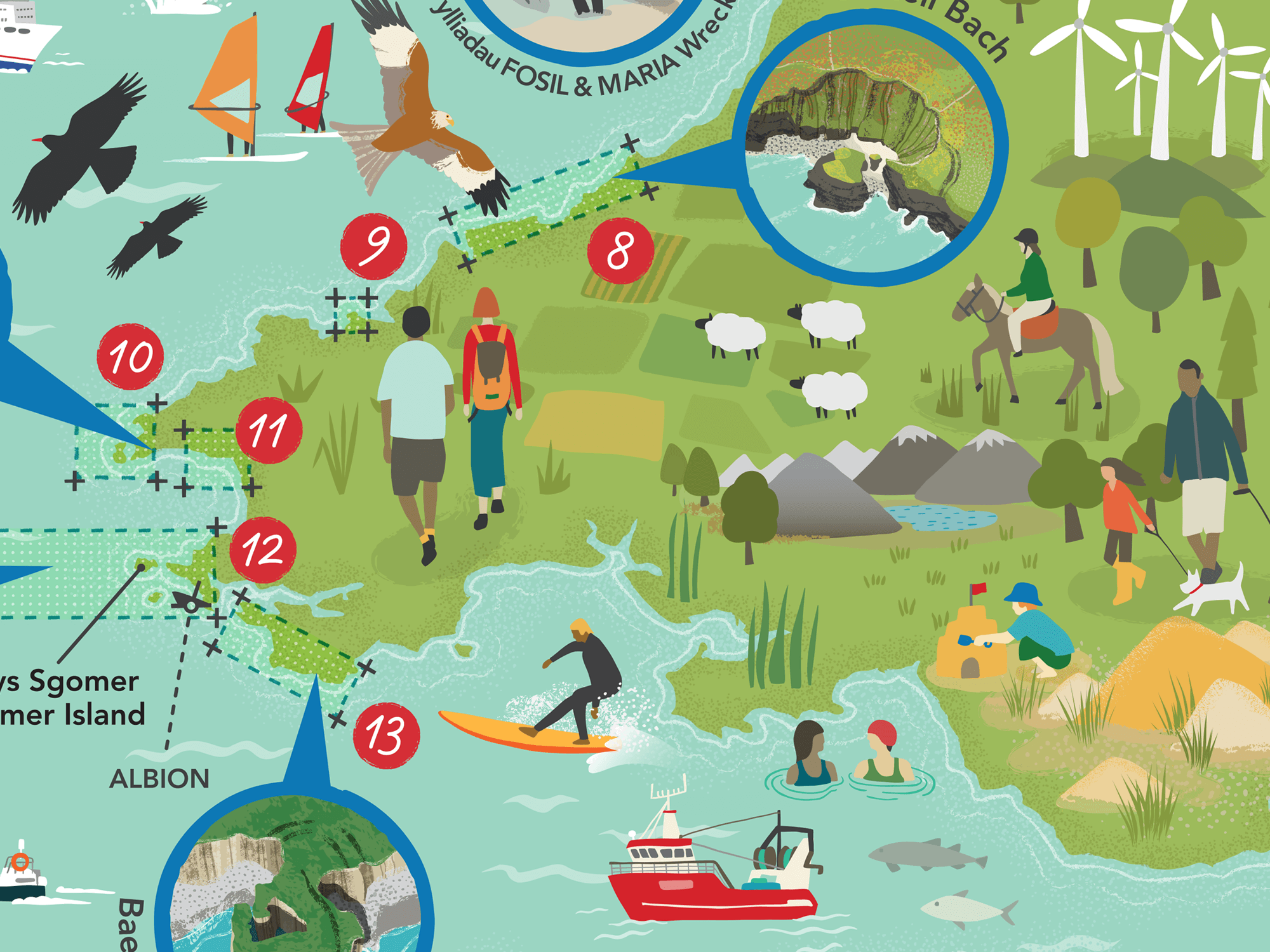
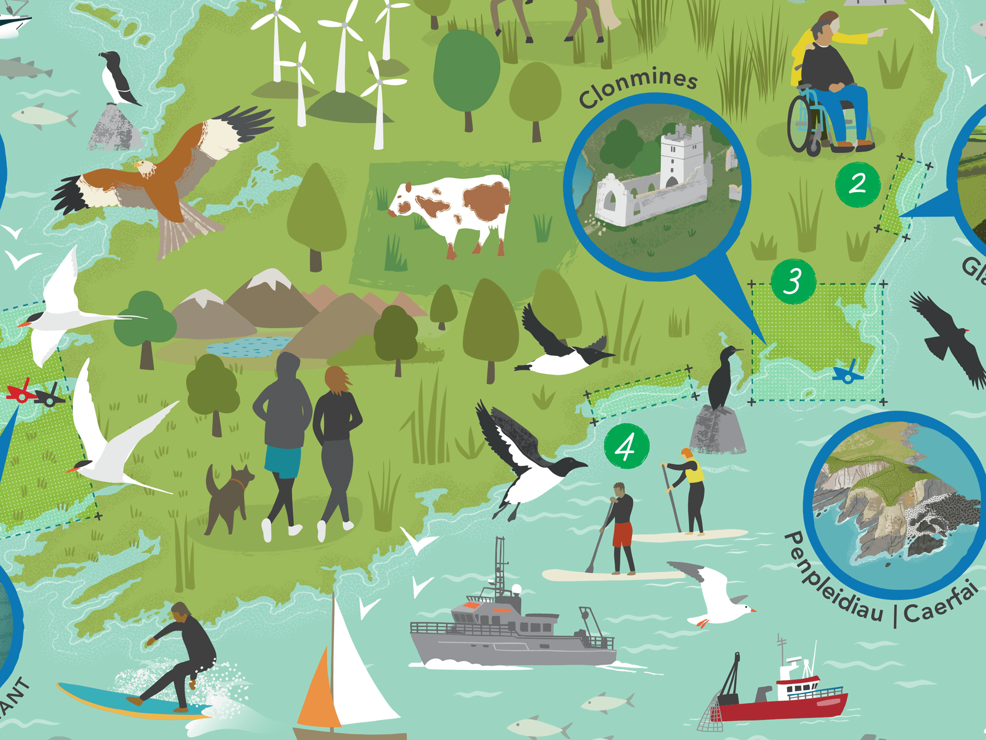
5 - Project Map for Ireland specific study areas
The CHERISH logo is shown below. Although the colour and style of the maps and illustrations aren’t directly tied to this, the existing brand colours are incorporated - using blue for highlighting locations and red and green for numbering on the Welsh and Irish maps respectively.

Pictured below are the initial sketches I created for the project, shown to the client as an initial stage. These were intended to give a general overview on the overall proposed layouts and content for each illustration, but there were some limitations. Time was relatively tight for showing the initial stage sketches so I didn’t include all the people/activity/landscape features that populate the final map illustrations, and instead simply gave a sense of these. Also, for the Toolkit graphic, this was to be based on an existing version so there was no real need for a sketch, instead I went straight to artwork for that one.

If you’re interested to find out more about the project, feel free to check out the CHERISH website. There are a number of newsletters which can be accessed via the homepage and give a really good overview of the work they’ve been doing. The touring exhibition will also be visiting coastal locations close to the study sites, details for these will no doubt be published in due course.
CLIENT FEEDBACK
Once the project was complete, Clare Lancaster, who is the Project Manager of CHERISH kindly gave me some feedback on how the process and development of these illustrations had been for them…
I believe you looked at other illustrators who may have been able to deliver the required work… What was it that led to you approaching Carys in the first instance and then to decide that she was the best fit for you and the CHERISH project?
We looked at other illustrators to deliver the work but Carys’s style and ethos behind which projects she worked with drew us to her, the examples on the website showed the variety of projects and illustrations that she has worked on and it was clear that her talent would allow us to have our thoughts and hopes for the illustrations visualised.
How did you find the overall process, from the initial briefing through to the completion of your project - Were there any areas that could be improved?
Carys was very clear from the outset as to what she needed from us, from the initial meeting to discuss our first thoughts and hopes for the illustrations, through the sketching phases to the meetings and feedback sessions which allowed us the opportunity to have the illustrations exactly as we wanted. The only improvement would be from our side in terms of being as clear as possible initially about our requirements and understanding the process required to produce the illustrations so that we are able to provide Carys with as much information as possible. Carys’s experience and knowledge were shared with us and this allowed us to have illustrations that went beyond our expectations.
Are you happy with the final work, did Carys deliver as you had hoped/expected?
We are exceedingly happy with the final work, Carys has produced amazing illustrations that will be a fantastic legacy for the project and we are looking forward to launching them in our exhibition.
And finally, if you were to describe Carys to someone else looking to commission a body of illustration work, what would you say?
Without hesitation I would recommend Carys to anyone looking for an illustrator, her talent is clear to see, her approach and patience when dealing with an enthusiastic team of specialists in their field has produced illustrations that we are very proud of.
- Clare Lancaster | Project Manager, CHERISH
RELATED PROJECTS

VALUABLE CONTENT | Illustrated map of the ‘Content Marketing Journey’

AINSLEY’S CARIBBEAN KITCHEN | Cookery book endpapers